
US-53 Eau Claire Bypass Construction Photos, May 29, 2004
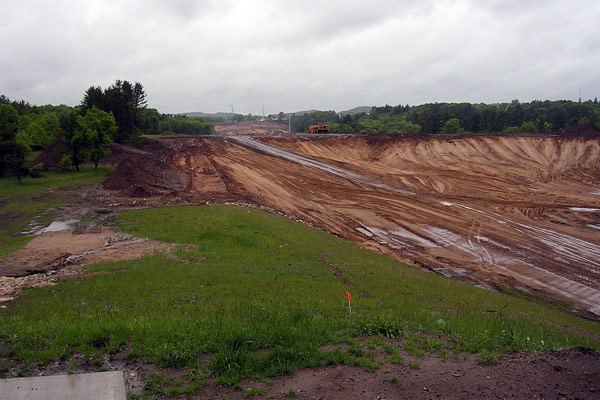
View of the US-53 freeway bypass of Eau Claire under construction on May 29,
2004. Photo taken from the CTH-A/Highland Ave overpass in Altoona looking
southerly. Photo ©2004
by Christopher J. Bessert. All Rights Reserved. Photos may not be used in
any manner without prior written permission.
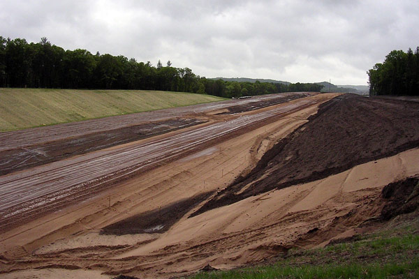
View of US-53 freeway from the CTH-A/Highland Ave overpass taken on May 29,
2004. At the crest of the rise in the distance is the Union Pacific Railroad
overpass. Photo ©2004
by Christopher J. Bessert. All Rights Reserved. Photos may not be used in
any manner without prior written permission.
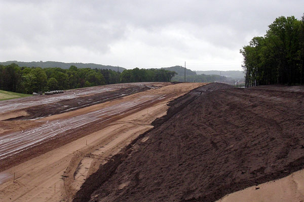
Another shot of the same location as the previous one above, zoomed into the
distance more. Photo ©2004
by Christopher J. Bessert. All Rights Reserved. Photos may not be used in any
manner without prior written permission.
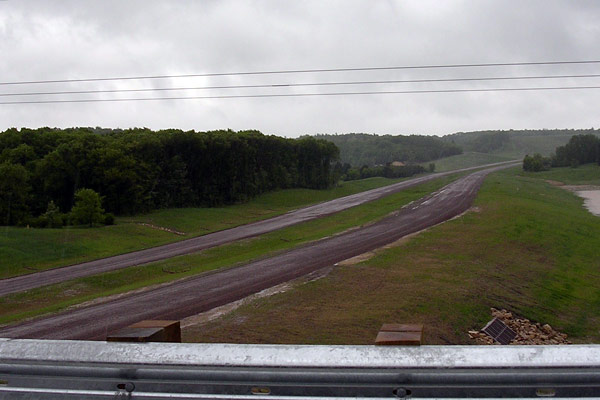
View looking north along the US-53 freeway under construction on May 29, 2004
from the Fuller Ave overpass about 1/2 mile north of the STH-312/CTH-Q North
Crossing interchange. Photo ©2004
by Christopher J. Bessert. All Rights Reserved. Photos may not be used in any
manner without prior written permission.
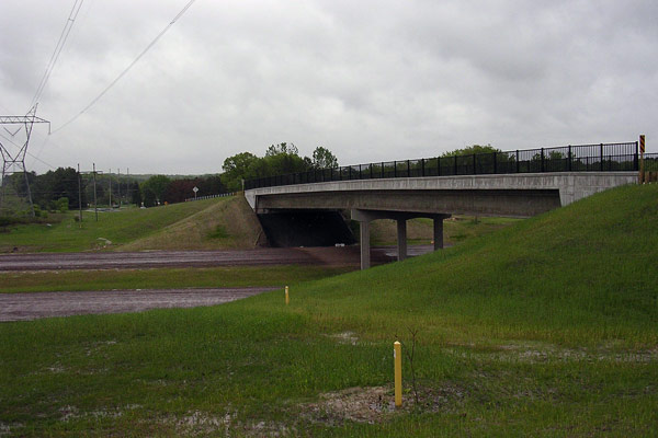
Fuller Ave overpass spanning the US-53 freeway east of Eau Claire, taken looking
east on May 29, 2004. At this point, the freeway lanes were graded with the
sub-base in place, but paving had not yet taken place. Photo ©2004
by Christopher J. Bessert. All Rights Reserved. Photos may not be used in
any manner without prior written permission.
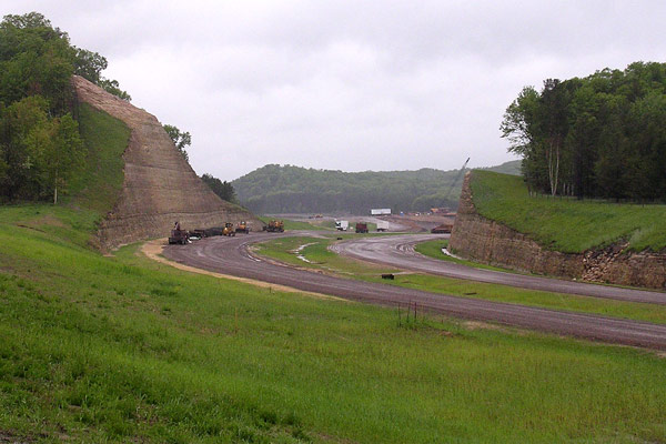
A view of the southern large cut created for the US-53 freeway in the City
of Eau Claire. Photo taken on May 29, 2004 from Fuller Ave east of the new
freeway looking southerly toward the new North Crossing interchange. Photo ©2004
by Christopher J. Bessert. All Rights Reserved. Photos may not be used in any
manner without prior written permission.
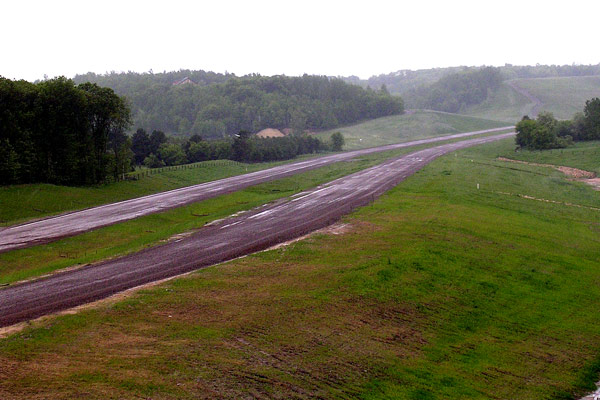
Another view of the US-53 freeway taken on May 29, 2004 from Fuller Ave looking
northerly. Photo ©2004
by Christopher J. Bessert. All Rights Reserved. Photos may not be used in any
manner without prior written permission.
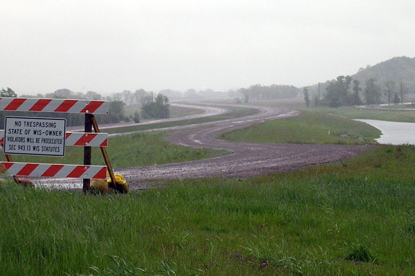
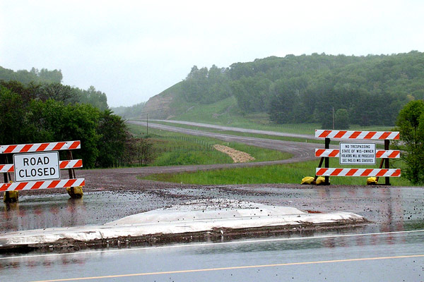
View of the US-53 freeway under construction in Lake Hallie northeast of Eau
Claire on May 29, 2004. In this photo, taken from Melby St looking northerly,
shows the northbound on-ramp from Melby St. Also shown is a rather sternly-worded
sign stating: "No Trespassing. State of Wis—Owner. Violators will
be prosecuted, Sec 943.13 Wis Statues." It would seem that WisDOT is serious
about people not taking scenic trips down the uncompleted freeway... Photo ©2004
by Christopher J. Bessert. All Rights Reserved. Photos may not be used in
any manner without prior written permission.
A view of the US-53 freeway looking southerly from Melby St on May 29, 2004.
This photo also shows the northbound off-ramp from the new freeway to Melby
St. Visible in the distance is the northern of the two major cuts created
for the project. Photo ©2004
by Christopher J. Bessert. All Rights Reserved. Photos may not be used in
any manner without prior written permission.
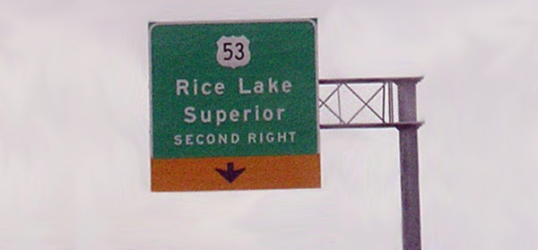
This somewhat grainy photo shows the temporary overhead sign erected along
northbound US-53/STH-124/Hastings Way approaching the CTH-OO intersection.
From 2003 to June 2005, US-53 traffic was diverted off Hastings Way, travelling
easterly via a relocated CTH-OO to the southern end of the completed US-53
freeway. Prior to 2003, US-53 continued straight through this intersection
for an additional half mile to the original US-53 trumpet interchange, which
was removed for this project. Photo ©2004
by Christopher J. Bessert. All Rights Reserved. Photos may not be used in
any manner without prior written permission.
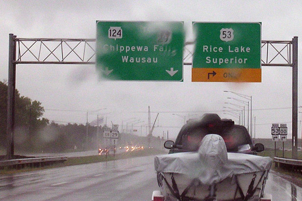
Although marred by the raindrops on the car windshield, the sgns on this overhead
assembly were changed in 2003 to indicate US-53's temporary turn at CTH-OO
to meet up with the southern end of the completed bypass at the time. Today,
STH-124 turns easterly via the relocated CTH-OO route, shown here as part of
US-53 to Rice Lake and Superior. Photo ©2004
by Christopher J. Bessert. All Rights Reserved. Photos may not be used in any
manner without prior written permission.
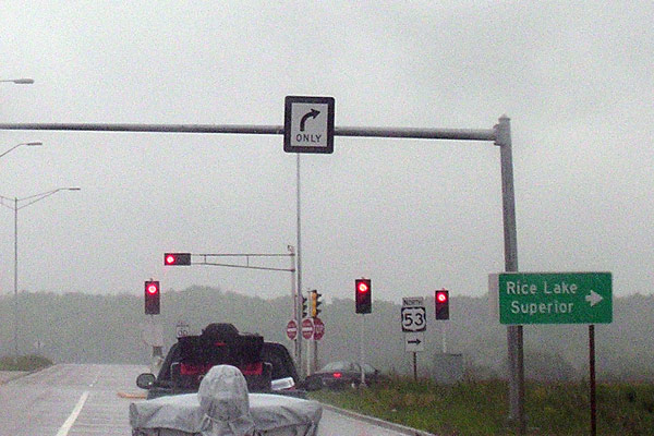
Looking easterly along the temporary route of US-53 (relocated CTH-OO) in
Lake Hallie at the southern end of the completed US-53 freeway, taken on
May 29, 2004. At the time, northbound US-53 traffic turned right onto what
is now the southbound US-53 on-ramp, as the ramp was configured to feed
into the northbound lanes of the new freeway. This was done to eliminate
crossing the "streams of traffic" from US-53 while the remainder of the
Eau Claire bypass was being constructed. Prior to the completion of BYP
US-53 from the CTH-OO interchange southerly to the STH-312/CTH-Q/North
Crossing interchange in 2005, the temporary ramp was eliminated and traffic
heading toward Rice Lake and Superior was then routed via the "regular"
on-ramp from this highway. Photo ©2004
by Christopher J. Bessert. All Rights Reserved. Photos may not be used in
any manner without prior written permission.
Additional Information
"Dedicated to the past, present and future of the Wisconsin State Trunk Highway system as well as other highways and routes throughout the Badger State. This website is intended to be a clearinghouse of information on Wisconsin's highways, from easily-recognized facts to the little-known trivia. It is also meant to change as the state highway system changes."