|
Highways 40 through 49STH-40 | I-41 | US-41 | STH-42 | SPUR STH-42 | I-43 | STH-44 | US-45 | STH-46 | STH-47 | STH-48 | STH-49 | Jump to Bottom | ||||||||||||||
Southern Terminus: |
|||||||||||||||
Northern Terminus: |
STH-27/STH-70 at cnr Clark Ave & Omaha St in downtown Radisson |
||||||||||||||
Length: |
81.56 miles |
||||||||||||||
|
Map: |
||||||||||||||
|
Notes: |
As a part of the conversion of STH-29 between I-94 at Elk Mound and Chippewa Falls to a limited-access expressway/freeway combination, both US-12 and STH-40 were relocated at their interchange with I-94 at Elk Mound (Exit 52). Construction on the relocation began in 2000 and was completed in the fall of 2001. |
|||||||||||||
|
History: |
STH-40, as originally designated and signed in 1918, utilized its present-day corridor from STH-14 (now US-8) at Bruce northerly to STH-70 (now STH-27/STH-70) in Radisson. However, approximately on year later, STH-43 (now part of STH-27), which ran from Cadott northerly to Ladysmith, was extended northly via present-day STH-27 to CTH-A, then northwesterly via CTH-A to STH-40, then northerly again supplanting the STH-40 designation into Radisson. This reduced STH-40 to a short connector route between Bruce and STH-43 north of Bruce. However, by 1924 STH-40 had been extended on the south along its present route from Bruce through Island Lake, Bloomer and Colfax to terminate at STH-116 (now STH-29) north of Elk Mound. |
|||||||||||||
|
|
In 1937, STH-40 was realigned on its southern end from Colfax to utilize a more direct route to the US-12 & STH-29 junction. When a new, "straight-as-an-arrow" alignment for STH-27 heading due northerly from Ladysmith was completed in 1945, the former route of STH-27 from north of Ladysmith to STH-40 as well as all of STH-27 (nee STH-40) from that point northerly was turned back to local control. In addition, the "spur" of STH-40 from Bruce northerly to STH-27 north of Bruce was also turned back to local control and the entire Bruce-to-Radisson route was designated CTH-H. However, the State Transportation Commission reversed themselves in 1952 when the entire length of the "original" STH-40 route (from Bruce to Radisson) including the portion which had been redesignated as STH-43-then-STH-27 in the past were returned to the state trunkline system as an extension of STH-40, bringing the highway to its present-day length. |
|||||||||||||
|
|
During 1999, a western bypass of the Village of Bruce was constructed to carry STH-40 directly south from a sharp turn in the highway northwest of downtown to a new intersection with US-8 on the western end of the village. STH-40 then turned easterly along US-8 back it its existing alignment on Main St downtown. The former route was turned back to local control and designated BUS STH-40. |
|||||||||||||
|
Freeway/Expwy: |
None. |
|||||||||||||
|
Business Connection: |
BUS STH-40 - Bruce: Site contributor Eric Nyman reports a BUS STH-40 route exists through the small community of Bruce in Rusk Co, west of Ladysmith. It runs from jct US-8 & STH-40 in Bruce and heads northerly via Main St to Railroad Ave and westerly via Railroad back to STH-40 west of town. —Thanks Eric! |
|||||||||||||
|
Photographs: |
|
|||||||||||||
|
Weblinks: |
• WIS 29 corridor maps - WIS 29/US 12/WIS 40 Interchange - diagram of the new (2001) interchange configuration at the southern terminus of STH-40 at jct US-12 & STH-29 from WisDOT. |
|||||||||||||
Southern Entrance: |
|
||||||||||||||
Northern Terminus: |
|
 |
|||||||||||||
Length: |
|
||||||||||||||
Map: |
|||||||||||||||
Notes: |
|
||||||||||||||
|
|
||||||||||||||
|
|
||||||||||||||
|
|
|
|||||||||||||
|
|
|
|||||||||||||
|
History: |
US-41: The Complete History. Since the route of I-41 is 100% concurrent with US-41, please consult the detailed history of US-41 which includes a year-by-year breakdown of its changes and realignments over the decades. That page can be found in the In Depth section of this website. |
|||||||||||||
|
|
According to the Wisconsin Transportation Commission's "Wisconsin Highways 1945-1985," the original Interstate connection between Milwaukee and Green Bay was to be along the route of US-41. It notes that in December 1956, "A Milwaukee-Green Bay (Hwy. 41) route was approved, but the state failed to get plans completed in time to meet a deadline and the effort failed, according to G. H. Blake, a legislator at the time." In the end, Green Bay's Interstate connection came along the US-141 corridor along Lake Michigan, and was built largely during the 1970s, while the route of US-41 in the Fox Valley was slowly upgraded over the years to freeway status. US-41 between greater Milwaukee and Green Bay eventually received its Interstate designation April 7, 2015 with I-41 signs erected along the corridor later in the year. |
|||||||||||||
|
Freeway: |
|
|||||||||||||
|
NHS: |
|
|||||||||||||
|
Business Connections: |
None. |
|||||||||||||
|
Continue on: |
US-41 southerly into Illinois – via Rich Carlson's Illinois Highways website. |
|||||||||||||
|
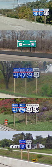
Photographs: |
|
|||||||||||||
|
Weblinks: |
• US-41: The Complete History – a detailed history of US-41 along with a year-by-year breakdown of the changes and realignments to the route over the decades. • • |
|||||||||||||
Southern Entrance: |
|
||||||||||||||
Northern Entrance: |
From Michigan on the Interstate Bridge spanning the Menominee River between Menominee, Michigan and Marinette |
||||||||||||||
Length: |
224.27 miles |
||||||||||||||
|
Map: |
||||||||||||||
|
Notes: |
It is safe to say US-41 has been one of the more interesting highways in Wisconsin over the past decade or so, with massive upgrades, construction and relocations so that 90% of the route is currently four-lane (or more) divided highway, with a total of 87% built to either freeway or expressway standards. The two remaining portions of US-41 which are not four or more lanes limited-access are the Lisbon & Appleton Ave portion in Milwaukee and the segment from Oconto to Peshtigo, as well as a short portion through Marinette. |
|||||||||||||
|
|
One of the biggest projects along US-41 has been the conversion of the expressway connecting Metro Milwaukee and Green Bay to a full freeway, with access only at interchanges. Originally, only short portions of US-41 in the Appleton and Green Bay areas were built to full freeway standards, while the remainder of the route was slowly upgraded to expressway quality, first, and now to freeway standards. Freeway conversion began during the 1960s and during the very late 1990s, was nearing completion with a flurry of work in Washington, Dodge and Fond du Lac Counties in the south and in Brown Co in the north. As of 2001 all of the remaining crossroads had been closed, diverted or grade-separated and US-41 was officially a fully-controlled access freeway from the north side of Milwaukee to well north of Green Bay. See the US-41: The Complete History page for complete historical details. |
|||||||||||||
|
|
The last major at-grade intersection in Fond du Lac Co at CTH-N/CTH-I northwest of Fond du Lac was converted to a freeway interchange, completed in 2001, with US-41 overpassing CTH-N/CTH-I. Simultaneously, the four remaining crossroad intersections in Fond du Lac Co either received grade separations or had access completely removed to convert this portion of expressway to freeway. In Outagamie and Brown Counties, construction was underway at the same time to convert that segment of expressway to freeway. Frontage roads were added to much of this route, removing access from US-41 for local roads and residential driveways. Two interchanges were constructed in this 10-mile stretch at CTH-U/CTH-DD and CTH-S. The freeway conversion project between Kaukauna and De Pere cost $35 million when it was completed in 2001 it opened two years earlier than originally anticipated. |
|||||||||||||
|
|
Major changes to the routing of US-41 occurred in Milwaukee County in 1999. Instead of departing I-94 at Exit 325 at the Milwaukee/Racine Co line as it has since I-94 was completed in the 1960s, US-41 is now routed concurrently with the I-94/North-South Frwy through the southern Milwaukee Co suburbs to the Mitchell Interchange (jct I-94 & I-894/I-43), then continues northerly with the I-94/I-43/North-South Frwy into downtown Milwaukee. There, US-41 follows I-94 through the Marquette Interchange and westerly via the East-West Frwy toward the Stadium Interchange west of downtown where it rejoins its former routing at the Stadium Frwy and continues northerly as before. The former route of US-41 along S 27th St from the Milwaukee/Racine Co line to STH-24/Forest Home Ave in southern Milwaukee has been re-designated STH-241, while S Layton Blvd between STH-24/Forest Home Blvd and STH-59/National Ave is no longer a state trunkline highway. The portion of the Stadium Frwy rebuilt to carry it around Miller Park construction and temporarily re-titled the "Stadium South Arterial" received a brand-new, yet hidden (unsigned) STH-341 designation and the more official "Miller Park Way" name. In an August 2, 1999 article, the Milwaukee Journal-Sentinel wrote: "The renumbering follows a successful battle by south side residents and city officials to block the widening of Layton Blvd. between National Ave. and W. Lincoln Ave., a plan that would have sacrificed 280 trees. DOT officials relented and agreed to let the city rebuild the street within its current width. But they said the rebuilt street would not meet highway standards and could not retain its designation." |
|||||||||||||
|
|
Michael G. Koerner noted in misc.transport.road that WisDOT has been exploring the idea of constructing a pair of bridges over Lake Butte des Morts near Oshkosh to solve some of the problems the current causeway is causing. Michael writes: "The fill and its three rather short bridges have been causing several problems, such as 'cutting' the lake in half, preventing the water from circulating like it should, and the snow on the lake ice blowing over the highway in winter has caused numerous bad accidents. Both problems would be corrected with such a long bridge (the water would circulate freely and the snow would blow safely under it)." He also notes these new bridges would likely be six-lane, 'Interstate-compatible' structures. |
|||||||||||||
|
|
Interestingly, WisDOT's "Official State Trunk Highway System Maps," still contains a "mapped corridor" for US-41 through the near northwest side of the City of Milwaukee, roughly along the line of the proposed Stadium (North) Frwy, which was cancelled in the 1970s. While most other originally "mapped corridors" have been erased from the trunkline system maps (if not from memory), this one corridor has been allowed to remain as a dashed line connecting the northern stub end of the never-completed Stadium Freeway with the southern end of the STH-145/Fond du Lac Frwy, running parallel to W Lisbon Ave and Appleton Ave to 60th St, then following 60th St northerly to Fond du Lac Ave. Whether for political or historical reasons, the corridor remains on the books, although WisDOT seems completely disinterested in building any new highway in the corridor nor do they seem poised to reroute US-41 via 60th St northerly to Fond du Lac Ave, although this change may make some sense. [See the Milwaukee County map from the OSTHSM booklet.] |
|||||||||||||
|
|
On a January 1998 trip along US-41, it was noted that all of the exit numbers on US-41 between the jct of US-41 & US-45 in Milwaukee (formerly Exit 47) and jct STH-33 (formerly Exit 72) had been removed. The milemarkers have remained along the entire route, but the exit number "tabs" on the advance exit signs have been removed and the exit number signs in the gores have also changed to plain "EXIT" signs. All exit numbers from Oshkosh to Suamico remained, however. Within a few years, new exit numbers had been installed... completely identical to the former ones! However, all interchanges along US-41 from Milwaukee to Abrams now feature exit numbers, a definite plus to the tens of thousands of motorists who travel corridor each day. |
|||||||||||||
|
|
The 75-year old US-41 Interstate Bridge spanning the Menominee River and linking Marinette with Menominee, Michigan was completely removed and replaced with a brand new bridge on the same location beginning with the sturcture's closure to traffic on Nov 1, 2004. During the project, US-41 traffic was detoured via the 26th St bridge just upstream—ironically the route of US-41 prior to 1929! The new structure was opened to traffic on Nov 22, 2005 and on Dec 3, 2005 a ribbon-cutting was held at the center of the bridge officially wrapping-up the 16-month project. According to Dick Lund's excellent photo-essay of the construction, the Honorary Ribbon-Cutter at the ceremony was Mrs. Catherine (VanCamp) Anderson, "who, as a girl of 12 was a holder of the ribbon which was cut to open the previous Interstate Bridge in a 1930 ceremony." |
|||||||||||||
|
History: |
US-41: The Complete History. So as to not make this highway listing exceeding long, a complete and detailed history of US-41 including a year-by-year breakdown of its changes and realignments over the decades can be found in the In Depth section of this website. |
|||||||||||||
|
|
|
|||||||||||||
|
Freeway: |
|
|||||||||||||
|
Expressway: |
|
|||||||||||||
|
NHS: |
|
|||||||||||||
|
Circle Tour : |
Lake Michigan Circle Tour: From I-43 at Exit 191 in Green Bay to US-41's entrance into Michigan at Marinette/Menominee. |
|||||||||||||
|
Business Connections: |
Former BUS US-41 - Oshkosh: While this business routing was not an official state trunk highway designation, it followed along other state trunk highways for its entire length, and so became, by default, a state highway. BUS US-41 at Oshkosh began at US-41 Exit 116 southwest of downtown and ran northeasterly via STH-44 along South Park Ave, Ohio St, Wisconsin St, and Irving Ave to US-45/Jackson St. From there, BUS US-41 turned north to run with US-45 and STH-76 along Jackson St northerly to US-41 at Exit 124, where it terminated. (For whatever reason, this BUS US-41 routing was removed from the Official State Highway Map in 1983. The route signage itself was removed by the early 2000s.) |
|||||||||||||
Former BUS US-41 - Appleton: This routing of BUS US-41 was also a locally-designated route, although a portion of the route did run along other state trunklines. Appleton's BUS US-41 began at US-41 at Exit 137 and ran easterly via College Ave, concurrently with STH-125 to STH-47/Memorial Dr-Richmond St, where it turned northerly to follow Richmond St concurrently with STH-47 for 12 blocks. At STH-96/Wisconsin Ave, BUS US-41 turned easterly for 2 miles to CTH-E/Ballard Rd, where it turned northerly again to run via locally-maintained CTH-E/Ballard Rd for less than 2 miles, ending at US-41 Exit 144. This BUS US-41 routing was removed from the Official State Highway Map in 1999 and, according to site contributor Peter Johnson, all BUS US-41 signs were removed from the route in 2004. —Thanks Peter! |
|||||||||||||||
|
|
BUS US-41 - De Pere (Green Bay): Prior to its complete removal, the status of this route changed from an official state trunkline designation to a locally-signed an maintained route, for the most part. Prior to 1998, BUS US-41 existed thusly: From US-41 at Exit 163B, BUS US-41 existed as an officially-designated state trunk highway to its merge with STH-32 along Ashland Ave, then continued northerly via Ashland co-signed with STH-32 to Lombardi Ave, where both STH-32 and BUS US-41 turned westerly to pass Lambeau Field. At the intersection of Lombardi Ave & Military St, STH-32 continued straight toward US-41, while the BUS US-41 designation changed from an official state trunkline designation to a locally-maintained and signed routing along Military St. Official WisDOT sources labled Military St as "Business 41 - Under Section 84.02(6)." At the northern end of this stretch, where Military St meets Velp Ave, the BUS US-41 designation once again became an official state trunk highway designation and turned westerly to follow US-141/Velp Ave to its end at US-41. While WisDOT had removed this routing as an official state trunk highway designation, it continued to be signed along its pre-1998 routing for several years. One of the reasons why it is assumed WisDOT made such a move was that Lombardi Ave, formerly STH-32 and along which BUS US-41 travels, was transferred to local control, and is now designated CTH-VK. The BUS US-41 routing at De Pere/Green Bay was removed from the Official State Highway Map in 1993 and, according to site contributor Peter Johnson, all BUS US-41 signs were removed from the route in 2004. Interestingly, the set of freeway ramps running between US-41 at Exit 163B in Ashwaubenon to STH-32/Ashland Ave in De Pere is still considered to be BUS US-41 by WisDOT, meaning the route still exists, albeit as a 0.67 mile highway! —Thanks Peter! |
|||||||||||||
|
|
|
|||||||||||||
|
|
|
|||||||||||||
|
Continue on: |
US-41 northerly into Michigan – via the Michigan Highways website. US-41
southerly into Illinois – via Rich Carlson's Illinois Highways website. |
|||||||||||||
|
Photographs: |
|
|||||||||||||
|
Weblinks: |
• US-41: The Complete History – a detailed history of this highway along with a year-by-year breakdown of the changes and realignments to the route over the decades. |
|||||||||||||
|
|
• |
|||||||||||||
|
|
• |
|||||||||||||
|
|
• |
|||||||||||||
|
|
• Milwaukee Freeways – including articles on freeways traversed by US-41: North-South Frwy, Airport Frwy, Zoo Frwy and Fond du Lac Frwy. |
|||||||||||||
|
|
• |
|||||||||||||
|
|
• Southeastern Wisconsin Regional Planning Commission – known as "SEWRPC" or "Sewer-Pac," this organization provides basic information and planning services for the Southeastern Wisconsin Region. |
|||||||||||||
|
|
• Interstate Bridge (US-41) Project – a photo-essay website detailing the complete demolition and reconstruction of the US-41 Interstate Bridge spanning the Menominee River between Marinette, Wisc. and Menominee, Mich. An excellent site by Dick Lund. |
|||||||||||||
Southern Terminus: |
Jct STH-23 & STH-28 (cnr of 14th St & Erie Ave) in central Sheboygan |
||||||||||||||
Northern Terminus: |
Northport (2 miles east of Gills Rock) at the Washington Island ferry dock |
||||||||||||||
Length: |
137.76 miles |
||||||||||||||
|
Map: |
||||||||||||||
|
Notes: |
After World War II, the idea of memorializing the accomplishments of the 32nd Infantry Division gained favor and the follow statute was enacted: "84.104 32nd Division Memorial Highway. In order to commemorate the 32nd Infantry Division, also known as The Red Arrow Division, which, while composed mainly of men from Wisconsin, Illinois and Michigan, brought fame and glory to these states during World Wars I and II by their sacrifice, devotion and bravery and which is now established as a Wisconsin national guard division, the department [of transportation] is directed to establish a highway memorial designated route 32 by renumbering certain existing highways linking Illinois and Michigan through Wisconsin. Beginning at the Illinois-Wisconsin state line renumber state trunk highway 42 to a point where it joins the present Wisconsin state trunk highway 32 at Sheboygan;..." This meant all of STH-42 south of Howard's Grove (7 miles northwest of downtown Sheboygan) was re-designated as an extension of STH-32 through Port Washington, Milwaukee, Racine and Kenosha to the Illinois state line. The 7-mile stretch of STH-32 between Howard's Grove and downtown Sheboygan was then re-designated as STH-42. |
|||||||||||||
|
|
The Sturgeon Bay bypass routing of STH-42/STH-57 was completed c.1977, removing those highways from the old downtown routing and the historic bridge crossing Sturgeon Bay. Prior to that, though,an interesting emergency situation occurred when a ship hit the Sturgeon Bay bridge in 1960. According WisDOT's book "Wisconsin Highways 1945-1985," "Round-the-clock ferry service was established almost immediately for cars and trucks to keep traffic moving on Hwys. 42 and 57. The state also leased a barge to serve traffic for the three weeks that it took to repair the main bridge." |
|||||||||||||
|
History: |
In 1918, the original routing of STH-42 began at the Illinois state line south of Monroe and continued northerly via the present-day STH-69 corridor through Monroe, Monticello and New Glarus, terminating in Verona at STH-19 (later US-18/US-151, now CTH-MV). During the state trunkline expansion of 1923, the first iteration of STH-42 was supplanted entirely by an extension of the route of STH-31 (which ran along today's US-151 from Manitowoc to Madison and Verona, then southerly via STH-42 to the Illinois line). The second iteration of STH-42 dawned when a highway beginning at STH-17 (later US-141) at Cedar Grove and proceeding northerly via present-day STH-32 to Howards Grove, then continuing northerly via the present STH-42 corridor to STH-31 (now US-151) southwest of Manitowoc. From there, STH-42 continued northerly via the present-day Vista Rd and CTH-R/Rapids Rd corridors, ending at jct STH-16 (later US-141) and STH-18 (later US-10) at "Four Corners," at the cnr of Menasha Ave-Plank Rd & Rapids Rd. |
|||||||||||||
|
|
A pair of major extensions to the route of STH-42 occurred in 1930 when it was extended southerly to the Illinois state line and northerly to near the tip of the Door Peninsula. From Cedar Grove, STH-42 was concurrently desginated with US-141 via Port Washington into downtown Milwaukee where it then supplanted the STH-15 designation southerly through Cudahy, South Milwaukee, Racine and Kenosha, terminating at a connection with IL SR-42 at the state line. From southwest of Manitowoc, STH-42 then turned northeasterly via STH-31 (now US-151) into downtown where it then supplanted the route of STH-17 northerly through Two Rivers, Kewaukee, Algoma, Sturgeon Bay and Egg Harbor, terminating at STH-57 (recently redesignated from STH-78) in Sister Bay. In 1934, STH-42 was extended northerly from Sister Bay through Ellison Bay to a new terminus at Gills Rock. |
|||||||||||||
|
|
In 1951, all of STH-42 from Howards Grove southerly to the Illinois state line was redesignated as an extension of STH-32 as part of the effort to designate the 32nd Division Memorial Highway. STH-42 was then rerouted southeasterly from Howards Grove over what had been STH-32 to a new terminus in downtown Sheboygan. In 1956, STH-42 was extended from Gills Rock to Northport at the tip of the Door Peninsula. Also in 1956, a westerly US-141 bypass of Manitowoc was completed and STH-42 was routed along the bypass from US-151 northerly to US-10 at Waldo Blvd then easterly via Waldo back to the highway's former route. |
|||||||||||||
|
|
In 1959, a realignment of US-141 north of Sheboygan lengthens the concurrent segment of US-141 with STH-42 terminus northwesterly from 15th St to the present-day cnr of Calumet Dr & N 40th St. Seven years later in 1966, the northern half of the US-141 Sheboygan bypass was completed and STH-42 continued by itself for the first time to its southern terminus in central Sheboygan. In 1969, the rest of the US-141 Sheboygan bypass was completed and STH-42 from its jct with US-141 into central Sheboygan was co-signed with BUS US-141, which then continued via the former route of US-141 southerly back to the new bypass route south of the city. In c.1977, the Sturgeon Bay bypass was completed (see note above). |
|||||||||||||
|
|
With the removal of US-141 in the Sheboygan area in 1980, what had been designated BUS US-141 via Sauk Trail (present-day Business Dr), 14th St, Michigan Ave, 13th St, and Calumet Dr was—for some odd reason—redesignated as BUS STH-42! STH-42 was scaled back to end at the new I-43 interchange northwest of the city, and BUS STH-42 continued from that point, through the city of Sheboygan, ending at I-43 Exit 48 (now Exit 120). In this sense, BUS STH-42 was not a business routing for STH-42, but for I-43! (Since Wisconsin refuses to use the Interstate Business Loop designation, this may have have been the 'next best thing.') About 1990, with the relocation of STH-28 to its present routing between Sheboygan Falls and Sheboygan, it seems the STH-28 designation was extended through the city of Sheboygan along what had been BUS STH-42, all the way to I-43 at Exit 56 (now Exit 128), with STH-42 retaining its 1980 terminus there. By 1993, however, the highway situation at Sheboygan had been finally straightened out so that STH-42 entered the city from the northwest, ending at a three-way terminus for STH-23, STH-28 and STH-42. |
|||||||||||||
|
Freeway: |
None. |
|||||||||||||
|
Expressway: |
The Sturgeon Bay bypass, concurrently with STH-57, from the southern BUS STH-42/BUS STH-57 junction at Green Bay Rd to the northern BUS STH-42/BUS STH-57 junction at Egg Barbor Rd. (4.8 miles) |
|||||||||||||
|
NHS: |
The following two segments of STH-42 in Wisconsin are on the National Highway System (NHS):
|
|||||||||||||
|
Circle Tour : |
Lake Michigan Circle Tour: From eastern jct of US-10 & STH-42 in Manitowoc to jct STH-57 in Sister Bay. |
|||||||||||||
|
Business Connections: |
BUS STH-42 - Manitowoc: Begins at jct I-43, US-151 & STH-42 southwest of the city and runs concurrently with US-151 northeasterly into the city via Calumet Ave & Washington St. At US-151's terminus at US-10, BUS STH-42 follows US-10 (along 10th St for sbd traffic and 8th St for nbd traffic) from downtown northerly back to STH-42 north of the city. |
|||||||||||||
|
|
BUS STH-42 - Sturgeon Bay: Posted concurrently with BUS STH-57. This is a locally-maintained and locally-signed business routing and is not a state trunkline highway. The route of BUS STH-42/BUS STH-57 contains several examples of old-style Wisconsin state trunkline markers, which have likely been in place since this route was a part of STH-42/STH-57 through the city in the 1970s. |
|||||||||||||
|
Photographs: |
|
|||||||||||||
|
Weblinks: |
• None. |
|||||||||||||
|
|
Southern Terminus: |
STH-42 in Gills Rock at the 90-degree intersection |
|||||||||||||
Northern Terminus: |
Island Clipper ferry dock just north of STH-42 in Gills Rock |
||||||||||||||
Length: |
0.075 mile / 400 feet |
||||||||||||||
Maps: |
|||||||||||||||
Notes: |
SPUR STH-42 is, by far, the shortest state trunk highway in Wisconsin, clocking in at approximately 1/13th of a mile, about 400 feet long. It connects STH-42 in Gills Rock with the Island Clipper ferry dock about one block north of where STH-42 turns easterly toward Northport (and the Washington Island Ferry Line). Since the highway is too small to show up on most maps, a USGS aerial photo and USGS topographic map excerpt are provided in the "Maps" section above. |
||||||||||||||
|
This route is one of only three "SPUR"-designated state trunkline highways in the state; the others are SPUR US-51 in Beloit and SPUR STH-794 in Saint Francis. |
||||||||||||||
|
Freeway/Expwy: |
None. |
|||||||||||||
|
Photographs: |
|
|||||||||||||
|
Weblinks: |
• None |
|||||||||||||
Southern Terminus: |
|||||||||||||||
Northern Terminus: |
|
||||||||||||||
Length: |
192.01 miles |
||||||||||||||
|
Map: |
||||||||||||||
|
Notes & History: |
Originally, Wisconsin was to only be home
to two mainline Interstates: I-90 and I-94.
However, the Transportation Commission lobbied long and hard to
connect other cities in the state to the system. According to WisDOT's "Wisconsin
Highways 1945-1985," the original Interstate connection between
Milwaukee and Green Bay was to be along the route of US-41.
It notes in December 1956, "A Milwaukee-Green Bay (Hwy.
41) route was approved, but the state failed to get plans completed
in time to meet a deadline and the effort failed, according to
G. H. Blake, a legislator at the time." The Transportation
Commission tried again in March 1958 for "additional mileage
between Marinette-Milwaukee," but was turned down less than
a month later. It wasn't until the 1970s that the federal government
approved a Milwaukee-to-Green Bay Interstate connection,
although at the same time proposals for awarding Interstate status
to US-51, US-53 and
STH-29 were denied. |
|||||||||||||
|
|
The original routing of I-43 was to only serve as a Milwaukee-to-Green Bay Interstate connection and was only later extended along a route Wisconsin had been trying to have added to the Interstate system since the early days. In the early 1970s, the federal government denied the state's request to connect Milwaukee and Beloit with an Interstate (as well as a companion Milwaukee-Janesville connection). Local and state officials still saw the need in having such a connection, and momentum pushed the project along, with or without Interstate shields and funding. WisDOT's "Wisconsin Highways 1945-1985," notes: One of the many highway-promoting bodies was the "Highway
15 Committee" composed of such as Eugene H. Grobschmidt, the
Milwaukee County Board Chairman; Henry W. Maier, Milwaukee Mayor;
Martin F. Schreiber, Sr., Milwaukee City Council President; Martin
F. Schreiber, Jr., a State Senator who later became Lieutenant
Governor and Acting Governor, and George Whittow, then a Milwaukee
alderman. In 1969, the first segment of the STH-15/Rock Frwy freeway opened from US-45/STH-100 in Greenfield to just west of CTH-F (now STH-164) near Big Bend. In 1972, the year when the "Highway 15 Committee" had hoped to have STH-15 completed as a freeway, the Big Bend-to-East Troy segment was opened to traffic. In 1973, the freeway was extended from East Troy to a connection with the US-12 freeway at Elkhorn. In late 1976, the Elkhorn to I-90 gap was completed; Milwaukee and Beloit were now connected by an Interstate-quality freeway. Eleven years later, I-43 was officially extended from Milwaukee to Beloit via STH-15 on November 24, 1987. The route was signed as such during 1988. To connect the two segments of the highway, the I-43 designation was applied to I-894/Airport Frwy and I-94/North-South Frwy as well. By 1991, all of the exits north of Milwaukee were renumbered to correspond with I-43's new length as measured from Beloit. |
|||||||||||||
|
|
Although no concrete proposals exist to extend I-43 in any direction from Green Bay, occasional rumors to that effect do surface, which either run I-43 northerly via US-41/US-141 or northwesterly along STH-29 toward Shawano. Site contributor Jon Enslin suggests that if any extension of I-43 were to occur at Green Bay, it may have to be rerouted onto the STH-172 freeway to US-41. Jon notes, "At the current end of I-43, where it exits to US-41, the interchange is not up to interstate standards and is sitting on a protected wetland." Again, no concrete proposals to do so currently exist, so this subject is just conjecture at this point. —Thanks Jon! |
|||||||||||||
|
Freeway: |
Entire route. |
|||||||||||||
|
NHS: |
Entire route. |
|||||||||||||
|
Circle Tour : |
Lake Michigan Circle Tour: four segments:
|
|||||||||||||
|
Photographs: |
|
|||||||||||||
|
Weblinks: |
• Interstate 43 - from InterstateGuide.com brought to you by the fine folks of AAroads.com. |
|||||||||||||
|
|
• Marquette Interchange Project - a comprehensive website all about the massive Marquette Interchange Reconstruction Project in downtown Milwaukee from WisDOT. Includes traffic information, a project guide, maps and up-to-date news. |
|||||||||||||
|
|
• Milwaukee Freeways - including articles on freeways traversed by I-43: Rock Frwy, Airport Frwy and North-South Frwy. |
|||||||||||||
|
|
• Exit numbers on I-43 - from WisDOT. |
|||||||||||||
|
|
• Economic Development History of Interstate: 43 Corridor - a detailed and in-depth study by the FHWA of the impacts of the northern portion of the I-43 corridor between Milwaukee and Green Bay. (Interestingly, the introduction at this site borrowed heavily, without attribution, from a previous iteration of this website!) |
|||||||||||||
Southern Terminus: |
STH-22 in Pardeeville |
||||||||||||||
Northern Terminus: |
US-45 at cnr of Irving & Jackson Sts in downtown Oshkosh |
||||||||||||||
Length: |
63.86 miles |
||||||||||||||
|
Map: |
||||||||||||||
|
Notes: |
As a quick glance at a state map will reveal, STH-44 is "diagonal" route, running from near Portage to Oshkosh. Officially, WisDOT considers STH-44 to be a north-south highway. However, this route's north-south difference (when measured along a due north-south line between east-west tangents drawn through the termini) is only 35 miles, with the east-west difference is 38 miles, which would usually mean the route has a more east-west "tendency" than a north-south one. But the last word comes from WisDOT on this one, so this listing will concur with the official findings. |
|||||||||||||
|
History: |
Today's STH-44 runs along 17 miles of the original 1918 routing of the highway, from STH-33 to Manchester. Back in 1918, STH-44 began in Portage and continued easterly via today's STH-33 to northeast of Pardeeville where it turned northerly and easterly via Kingston to Manchester, then northerly along present-day STH-73 to a terminus at STH-23 east of Princeton. By 1921, STH-44 had been scaled back on the south to end at STH-33 northeast of Pardeeville. By 1924, though, the route had been extended northeasterly along its present corridor via Fairwater, Ripon and Pickett to end in Oshkosh, as well as extended southerly through Pardeeville and Wyocena, ending at the jct of STH-10 (now US-51) and STH-60. In 1947, the southermost 15 miles of STH-44 from Pardeeville southerly was redesignated as a part of STH-22. |
|||||||||||||
|
Freeway/Expwy: |
None. |
|||||||||||||
|
NHS: |
From US-41 at Exit 116 to northern terminus at US-45/Jackson St in downtown Oshkosh. |
|||||||||||||
|
Photographs: |
|
|||||||||||||
|
Weblinks: |
• None. |
|||||||||||||
Southern Entrance: |
From Illinois, 7 miles south of Bristol |
||||||||||||||
Northern Entrance: |
From Michigan (concurrently w/STH-32, which terminates at the state line) at Land O' Lakes |
||||||||||||||
Length: |
298.04 miles |
||||||||||||||
|
Map: |
||||||||||||||
|
Notes: |
Major
changes and a major rerouting of US-45 in the Greater Fox Cities
area occurred in 2003. Until that year, US-45 ran almost due northerly
from Oshkosh to Greenville (northwest of Appleton), then turned
northwesterly toward New London. US-45 was completely relocated
from this stretch onto partly-new and partly-existing highway between
Oshkosh and New London, via Winchester. The new route generally
follows the former STH-110 corridor
from Oshkosh to Winchester, then continues northerly along the
former CTH-W and CTH-D corridors to New London. Large-scale construction
began in 2001 and was wrapped up and all roads opened to traffic
on December 5, 2003. |
|||||||||||||
|
|
WisDOT has begun to plan for the conversion of the remaining two-lane segment of US-45 (former STH-110) from north of the CTH-G overpass northeast of Winneconne to Hansen Rd south of CTH-II at Winchester to four-lane divided expressway standards with access limited to select crossroads. WisDOT additionally notes: "This project will convert the existing two-lane expressway into a four-lane expressway by adding two additional lanes to the east of US 45. Nearly a mile of the existing lanes near Breezewood Lane and Woodland Drive will be reconstructed to improve sight distance. Right of way will be purchased for future frontage roads and overpass bridges, but they will not be constructed as part of this project." |
|||||||||||||
|
History: |
US-45 was a relative late-comer to Wisconsin, arriving almost a decade after the first US Highways were designated. In 1934, US-45 was extended northerly from Chicago, running the full length of the state, before entering Michigan heading toward its new terminus at Ontonagon. This new US Highway was designated along the following routes:
|
|||||||||||||
|
|
Over the ensuing decades, a number of major improvements were made to the route of US-45, including:
|
|||||||||||||
|
Freeway: |
The following three segments of US-45 exist as freeway:
|
|||||||||||||
|
Expressway: |
The following five segments of US-45 exist as expressway:
|
|||||||||||||
|
NHS: |
The following three segments of US-45 in Wisconsin are on the National Highway System (NHS):
|
|||||||||||||
|
Business Connection: |
BUS US-45 - New London: A locally-designated, locally-maintained business connection via the former route of US-45 (now CTH-D) through the City of New London from jct US-45 & STH-15 south of the city to jct US-45 & CTH-D north of the city. |
|||||||||||||
|
Continue on: |
US-45 southerly into
Illinois - via Rich
Carlson's Illinois Highways website. |
|||||||||||||
|
Photographs: |
|
|||||||||||||
|
Weblinks: |
• US 45 expansion project - from WisDOT: "US 45 (old WIS 110) is a major north-south route through east central Wisconsin and Winnebago County. The US 45 expansion project will develop this route into a four-lane, divided expressway with at-grade intersections and restricted private access." |
|||||||||||||
|
|
• Future Highway Name Changes: Effective October 31, 2003 - a handy map produced by WisDOT illustrating all of the various Fox Valley state trunkline route number changes resulting from the US-10 and US-45 relocation projects. |
|||||||||||||
|
|
• Milwaukee Freeways - including articles on freeways traversed by US-45: Rock Frwy, Zoo Frwy, Fond du Lac Frwy and West Bend Frwy. |
|||||||||||||
|
|
• Exit numbers on US 45 - from WisDOT. |
|||||||||||||
Southern Terminus: |
|||||||||||||||
Northern Terminus: |
STH-35 one mile northeast of Milltown |
||||||||||||||
Length: |
34.13 miles |
||||||||||||||
|
Map: |
||||||||||||||
|
Notes: |
|
|||||||||||||
|
History: |
STH-46 has existed in generally the same area since originally designated in 1917, with the US-63-to-Amery stretch existing on the same alignment to this day! In 1918, STH-46 was signed along present-day STH-65 beginning at STH-12 (now US-12) near Roberts to New Richmond, then east concurrently with STH-64 to the current STH-46 routing, then northerly through Amery, ending at STH-14 (now US-8). In the early 1920s, STH-46 was diverted to run southerly from STH-64 at Cylon through Baldwin and Martell to Ellsworth, then south along what had been STH-45 to the Red Wing bridge across the Mississippi River. In the late 1920s, STH-46 was extended northerly from US-8 to Balsam Lake, then westerly along present-day CTH-I to end at STH-35 at Centuria. In 1934, US-63 debuted in Wisconsin, completely replacing STH-46 from the Minnesota state line to STH-64 near Cylon. A year later, STH-46 was transferred onto a more direct alignment between US-8 and Balsam Lake and also rerouted to follow what had been CTH-K to STH-35 near Milltown. The former STH-46 between Balsam Lake and Centuria reverted back to its former county designation as CTH-I. |
|||||||||||||
|
Freeway/Expwy: |
None. |
|||||||||||||
|
Photographs: |
|
|||||||||||||
|
Weblinks: |
• None. |
|||||||||||||
Southern Terminus: |
STH-114 in downtown Menasha at cnr DePere & Third Sts |
||||||||||||||
Northern Terminus: |
|||||||||||||||
Length: |
188.01 miles |
||||||||||||||
|
Map: |
||||||||||||||
|
Notes: |
Under normal circumstances, what is currently designated as STH-47 would be three separate and distinct highways. But, this being Wisconsin, the STH-47 designation was extended and elongated into a somewhat odd routing which now stretches from the shores of Lake Winnebago to the forests of the Northwoods, only 25 miles out of Hurley. (See "History" section below for details on the evolution of this route.) The net result is one highway designation residing along what could be three separate routes, joined only via long concurrent stretches with other highways. Between Bonduel and Keshena, STH-47 exists along 19 miles of other highways (STH-29/STH-55 between Bonduel and Shawano; STH-55 alone north of Shawano) and prior to 1997, an additional 11 miles of STH-47 from Nichols to Bonduel were also concurrently designated with STH-55! From south of Antigo to Rhinelander, STH-47 runs concurrently for 53 miles with other highways (US-45 from south of Antigo to Monico; US-8 from there to Rhinelander). In all, 76 of the route's 188 miles are designated with other highways, which means only 60 percent (112 miles) of STH-47 exists by itself. |
|||||||||||||
|
History: |
Originally, STH-47 began in downtown Appleton at jct STH-15 (later US-41) and STH-18 (later US-10) and continued northerly in its present corridor, terminating at STH-16 (later STH-29) at Bonduel. In 1919, though, STH-47 had been extended northwesterly via STH-16 (later STH-29) to Shawano, then northerly along its present alignment through Keshena and Neopit to Phlox, where the highway then "stair-stepped" into Antigo (via present-day CTH-S and CTH-AA), ending at STH-39 (later STH-26, now US-45) there. By 1925, STH-47 had again been extended: from Antigo, it now shared the STH-26 (formerly STH-39, now US-45) route for 38 miles to Monico, then turned westerly via STH-14 (now US-8) for 15 miles into Rhinelander. There, STH-47 continued along the former routing of STH-39 through Lake Tomahawk, ending at STH-10 (now US-51) in Woodruff. In 1937 when much the original US-41 bypass of Appleton was completed, STH-47 was extended southerly via the former route of US-41 from Appleton to downtown Menasha. In 1952, STH-47 was once again extended northwesterly from its terminus at Woodruff along the route of CTH-F through Lac du Flambeau to STH-182, then north concurrently with STH-182 to end at US-51 at Manitowish. (STH-182 was 'commissioned' in this area in 1948, hence the four-mile concurrent STH-47/STH-182 stretch.) |
|||||||||||||
|
|
With the completion of the STH-29 "Shawano Bypass" in September 1998, the STH-47 designation was transferred to the new freeway from the Bonduel interchange to the new BUS STH-29/STH-47/STH-55/CTH-K interchange southeast of Shawano, adding approximately one mile to the length of STH-47. The former STH-29/STH-47/STH-55 from Shawano to Bonduel is redesignated as CTH-BE and turned back to local control. |
|||||||||||||
|
Freeway: |
Concurrently with STH-29/STH-55 from Bonduel to the new CTH-K interchange southeast of Shawano. (6.8 miles) |
|||||||||||||
|
Expressway: |
Concurrently with US-8 via the "Rhinelander bypass" from CTH-C near George Lake to jct US-8 [west] & BUS US-8 in Rhinelander. (6.1 miles) |
|||||||||||||
|
NHS: |
The following three segments of STH-47 in Wisconsin are on the National Highway System (NHS): |
|||||||||||||
|
Photographs: |
|
|||||||||||||
|
Weblinks: |
• None. |
|||||||||||||
Western Terminus: |
Jct STH-70 & STH-87 in Grantsburg at cnr Pine St & Skyline Dr |
||||||||||||||
Eastern Terminus: |
STH-40 two miles east of Exeland |
||||||||||||||
Length: |
98.19 miles |
||||||||||||||
|
Map: |
||||||||||||||
|
Notes: |
|
|||||||||||||
|
History: |
The first iteration of STH-48, as designated in 1917, began at Sheboygan and proceeded northwesterly through New Holstein and Chilton, ending at STH-18 (later US-10) at Hilbert. By 1921, STH-48 had been scaled back from Hilbert to end in New Holstein at STH-57 (which then ran along present-day CTH-J south of Holstein). By 1924, though, STH-32 had replaced all of the remaining original STH-48 near Sheboygan. |
|||||||||||||
|
|
The current iteration came about when the STH-48 was commissioned BY 1924 along a former county road from Rice Lake, through Cumberland and Loraine (now McKinley) to Luck, then north along STH-35 to Frederic, west again through Trade Lake to STH-87, then northerly co-signed with STH-87 to end at STH-70 in Grantsburg. (Why STH-48 and STH-87 were concurrently designated is yet unclear.) In 1956, STH-48 was extended northeasterly from Rice Lake by an additional 50 miles to its present eastern terminus near Exeland. |
|||||||||||||
|
Freeway/Expwy: |
None. |
|||||||||||||
|
Photographs: |
|
|||||||||||||
|
Weblinks: |
• None. |
|||||||||||||
Southern Terminus: |
US-41 at Exit 87 two miles north of Lomira |
||||||||||||||
Northern Terminus: |
STH-29 four miles west of Wittenberg |
||||||||||||||
Length: |
127.52 miles |
||||||||||||||
|
Map: |
||||||||||||||
|
Notes: |
This is one of those trademark WisconsinHighways™ which seem to jump from one logical alignment to another, as well as change direction a couple times. It could be argued that the current STH-49 routing would be four different highways under other circumstances. First, from STH-29 to Waupaca, STH-49 seems to follow one logical alignment, but is then concurrently designated with US-10 from Waupaca to Fremont, where it then departs south again along a second logical alignment to Green Lake. From there to Ripon, STH-49 moves laterally via STH-23, then south again on a third logical alignment to Waupun, where it makes a 90 degree angle to run easterly along a fourth logical alignment between Wapun and US-41. Then again, that's one of the reason's why Wisconsin's highway system is interesting... |
|||||||||||||
|
History: |
As originally designated in 1917, STH-49 followed the second of the so-called "logical alignments" from above, from Green Lake to near Fremont. By 1921, STH-49 had been extended along the stair-step route from Green Lake, through Ripon and Brandon, to end at STH-31 (later US-151) & STH-33 (now STH-68) in Waupun. By 1924, STH-49 had been extended northwesterly along STH-18 (now US-10) to Waupaca, then northerly generally along its present routing, replacing STH-87 from Waupaca to the present jct with STH-66 east of Rosholt, then replacing STH-66 northerly toward Wittenberg. In 1947, STH-49 was extended easterly from Waupun along a route which had not previously been a state trunk highway, to end at US-41. The portion through the northern end of the Horicon NWR was a lesser-quality roadway at first. In 1954, approximately a mile was tacked on to the south end of STH-49 when US-41 was constructed on its present alignment (albeit as a two-lane highway, not the current freeway) near Lomira. |
|||||||||||||
|
Freeway: |
Concurrently with US-10 along the "Waupaca bypass" from jct US-10, STH-49 & STH-54 easterly to the end of the freeway segment at CTH-A east of Waupaca. |
|||||||||||||
|
Expressway: |
Concurrently with US-10 from the eastern end of the "Waupaca bypass" freeway at CTH-A easterly to jct US-10, STH-49 & STH-110 at Fremont. |
|||||||||||||
|
NHS: |
Concurrently with US-10 from just west of Fremont to Waupaca. |
|||||||||||||
|
Photographs: |
|
|||||||||||||
|
Weblinks: |
• None. |
|||||||||||||
STH-40 | I-41 | US-41 | STH-42 | SPUR STH-42 | I-43 | STH-44 | US-45 | STH-46 | STH-47 | STH-48 | STH-49 | Up to Top |
|||||||||||||||


