
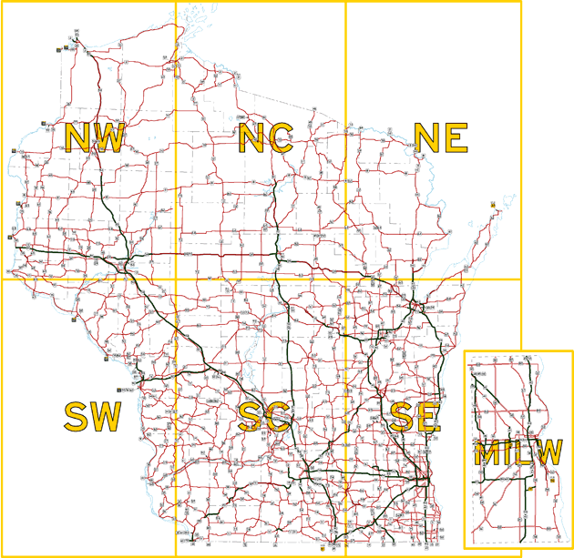
Wisconsin State Trunk Highway Overview Map
Click on one of the seven sections of the map below to view a close-up version of that region of the state: Northwest, North Central, Northeast, Southwest, South Central, Southeast and Milwaukee County. Each of these close-up maps display all of the state trunk highways in that area and allow you to click on individual routes to jump directly to that route listing.
Jump to:
Overview Map | Northwest | North
Central | Northeast
Southwest | South
Central | Southeast | Milwaukee
County