
BYPASS US-53 Photos, November 4, 2005 (Page 2 of 2)
This is the second of two featuring photos related to the former BYPASS US-53 route in the Eau Claire area, taken on November 4, 2005. BYPASS US-53 was a temporary route designation which existed from 2005 to 2006 while the remainder of the US-53 freeway around Eau Claire was being completed and these photos attempt to preserve the history of this temporary, and now decommissioned, route. This page consists of photos along the freeway portion of BYP US-53 (now part of US-53). Page 1 features photos related to the North Crossing Extension.
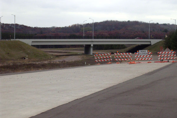
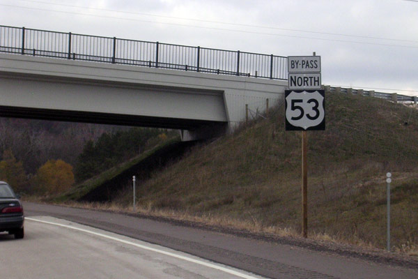
View of the North Crossing Extension overpass spanning the incomplete
US-53 bypass freeway at Eau Claire on November 4, 2005. This photo
was taken from the southbound off-ramp leading to the North Crossing
and shows the end of the completed freeway. The remainder of the highway
from this point southerly to the Oakwood Mall area would be completed
and opened to traffic within nine months. Photo ©2005
by Christopher J. Bessert. All Rights Reserved. Photos may not be used
in any manner without prior written permission.
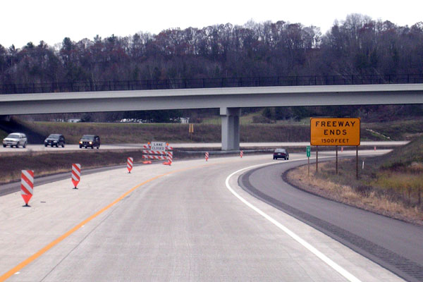
Southbound BYPASS US-53 (now just US-53) approaching the Fuller Ave overpass,
taken November 4, 2005. At the time, the freeway ended at the North Crossing
Extension just around the corner to the right and all traffic was forced
off there, hence the FREEWAY ENDS / 1500 FEET" sign and the closed left lane
in this photo. Photo ©2005
by Christopher J. Bessert. All Rights Reserved. Photos may not be used in
any manner without prior written permission.
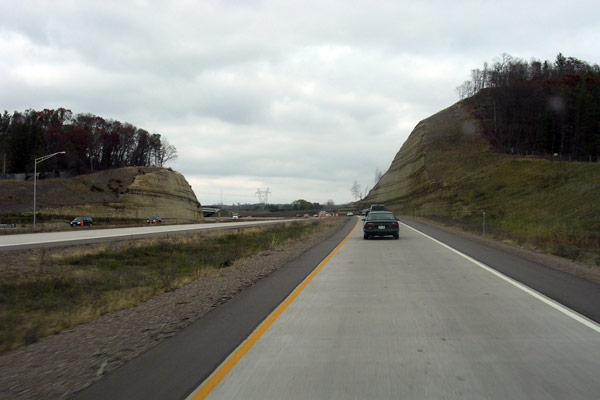
A view of the southern of two cuts made for the US-53 bypass freeway, taken
on November 4, 2005 from the northbound on-ramp from the North Crossing Extension.
Merging with traffic on the freeway was not necessary, as the freeway began
at this location from mid-2005 through mid-2006. In the distance, a tiny
piece of the Fuller Ave overpass is barely visible. Photo ©2005
by Christopher J. Bessert. All Rights Reserved. Photos may not be used in any
manner without prior written permission.
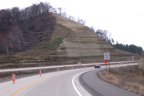
The southern cut along the US-53 bypass freeway (then signed as BYPASS US-53)
taken on November 4, 2005, looking south from the southbound lanes. Also
note the blocked left lane, the "ALL TRAFFIC MUST EXIT" sign and, in the
distance, a "SOUTH BYPASS US-53" route marker assembly directing traffic
off at the North Crossing Extension ramp. Photo ©2005
by Christopher J. Bessert. All Rights Reserved. Photos may not be used in any
manner without prior written permission.
A BYPASS US-53 route marker reassurance assembly on the northbound freeway
north of the North Crossing Extension in Eau Claire, taken November 4, 2005
(the Fuller Ave overpass is in the background). Normally, a simply reassurance
route marker assembly is not notable, however since BYP US-53 was a temporary
route, this assembly only existed for less than ten months. Photo ©2005
by Christopher J. Bessert. All Rights Reserved. Photos may not be used in
any manner without prior written permission.
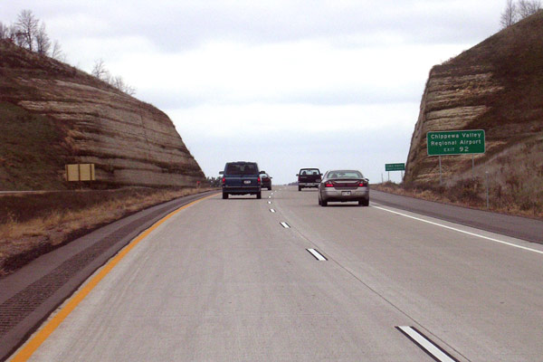
Looking northerly along the northbound lanes of BYPASS US-53 (now just US-53)
at the northern of two large cuts made for the freeway. The photo, taken
November 4, 2005, also shows some of the auxilliary exit signage ("Chippewa
Valley Regional Airport, Exit 92") for the Melby St interchange on the other
side of the cut. Photo ©2005
by Christopher J. Bessert. All Rights Reserved. Photos may not be used in any
manner without prior written permission.
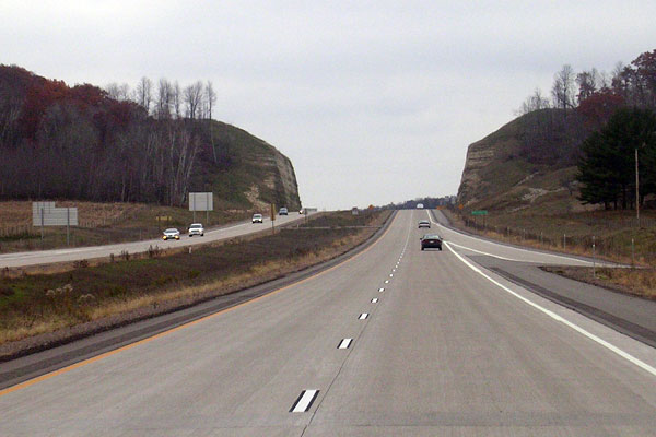
A view of the northern cut, this time looking south from the southbound lanes
of BYPASS US-53 (now just US-53) in Lake Hallie, taken November 4, 2005.
The Melby St southbound on-ramp is visible on the right. Photo ©2004
by Christopher J. Bessert. All Rights Reserved. Photos may not be used in any
manner without prior written permission.
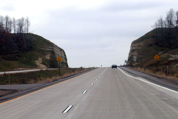
Another southbound view of the north cut several hundred yards ahead of the
previous photo. Note the final few feet of the Melby St on-ramp taper at
the lower right. Photo ©2005
by Christopher J. Bessert. All Rights Reserved. Photos may not be used in
any manner without prior written permission.
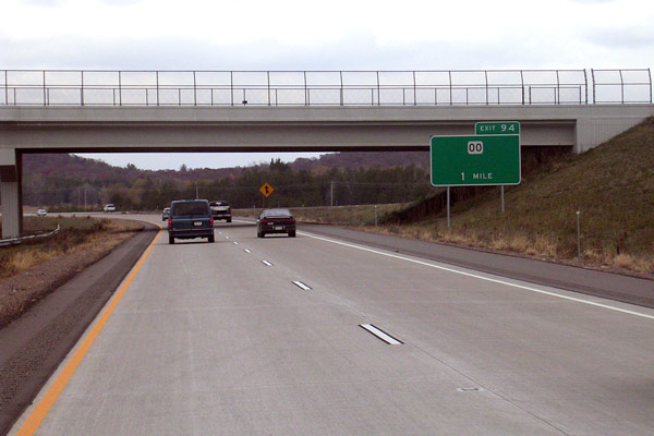
Advance exit sign along BYPASS US-53 (now US-53) northbound in Lake Hallie
for Exit 94. While it is clear this is not the permanent sign for this location,
the inclusion of just a CTH-OO route marker and "1 MILE" made it a very odd-looking
sign. This interchange now also serves as the access for STH-124 and Chippewa
Falls from the south, but at the time the photo was taken (November 4, 2005),
STH-124 had not yet been routed along CTH-OO. Compare this image with the
next photo. Photo ©2005
by Christopher J. Bessert. All Rights Reserved. Photos may not be used in
any manner without prior written permission.
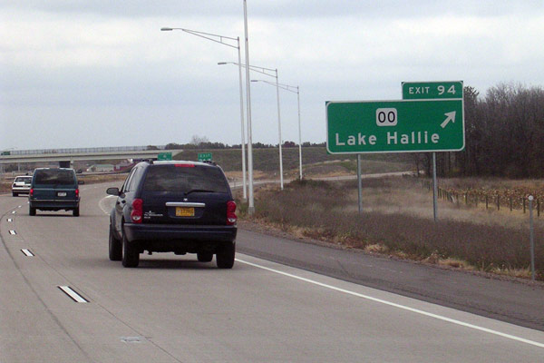
The final exit signage for Exit 94 northbound on BYPASS US-53 (now just US-53)
in Lake Hallie. Taken at the same time as the one in the previous photo,
this sign features both the CTH-OO route marker and the "Lake Hallie" legend,
while the previous sign only included the route marker. Both of these signs
have likely been removed and replaced with ones including STH-124 markers
and "Chippewa Falls" as well since the completion of the entire US-53 Eau
Claire bypass. Photo ©2005
by Christopher J. Bessert. All Rights Reserved. Photos may not be used in
any manner without prior written permission.
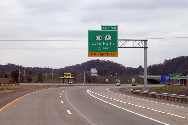
Exit signage at Exit 94 on southbound US-53 in Lake Hallie. This sign is interesting
in several ways, first signifying that the exit is for CTH-OO only and that
STH-124 is reached via CTH-OO. While that was technically true at the time
the photo was taken on November 4, 2005, within a few weeks STH-124 had been
truncated to this interchange at Lake Hallie and the "TO" would have been incorrect,
although WisDOT may have chosen to cover it up after that time. In addition,
this exit is also the northern terminus of BUSINESS US-53 and no room had been
left on this sign for the inclusion of a BUS US-53 route marker. Also, at the
time the photo was taken, the US-53 mainline designation exited the freeway
at this location, but that movement was rather poorly signed. Photo ©2005
by Christopher J. Bessert. All Rights Reserved. Photos may not be used in any
manner without prior written permission.
A BYPASS US-53 route marker reassurance assembly on the southbound freeway
south of the CTH-OO interchange in Lake Hallie, taken November 4, 2005
(an auxilliary sign for the Melby St interchange is in the background). Normally,
a simply reassurance route marker assembly is not notable, however since BYP
US-53 was a temporary route, this assembly only existed for less than ten months. Photo ©2005
by Christopher J. Bessert. All Rights Reserved. Photos may not be used in
any manner without prior written permission.
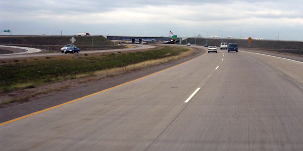
A view of the STH-29 freeway interchange from northbound US-53 in Lake
Hallie on November 4, 2005. Visible are the twin overpasses for the
STH-29 freeway bypass of Chippewa Falls, opened less than three months
earlier, as well as the ramp from eastbound STH-29 to southbound US-53
on the left side of the image. The US-53 freeway at this point had
been open for approximately two years. Photo ©2005
by Christopher J. Bessert. All Rights Reserved. Photos may not be used
in any manner without prior written permission.
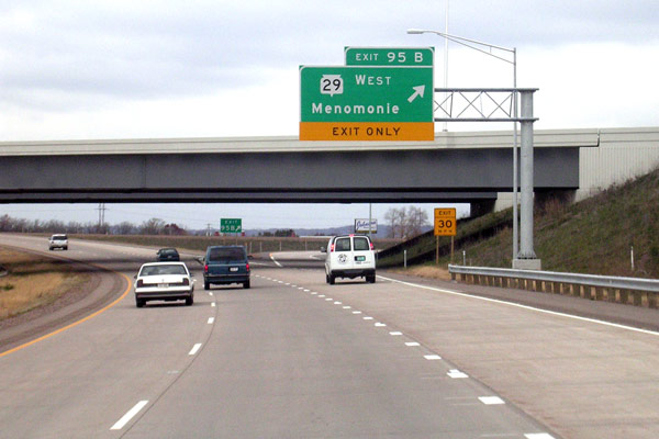
Another view of northbound US-53 at the STH-29 interchange in Lake Hallie,
taken on November 4, 2005 a few hundred yards north of the previous
photo. This photo shows the westbound control city for STH-29 is Menomonie. Photo ©2005
by Christopher J. Bessert. All Rights Reserved. Photos may not be used
in any manner without prior written permission.
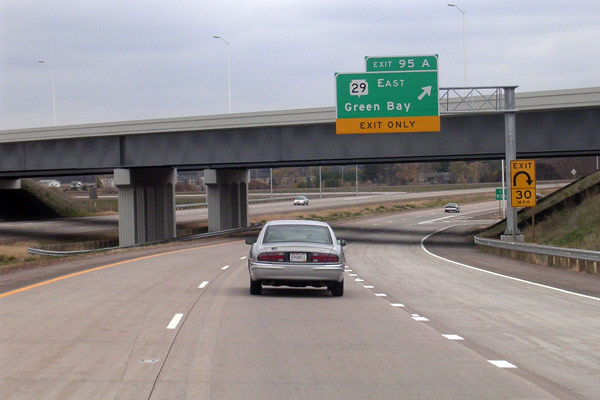
Yet another view of the STH-29 interchange in Lake Hallie, this time taken from
southbound US-53 and showing the twin STH-29 overpasses and the exit sign for
STH-29 EAST with a control city of Green Bay. While the US-53 freeway here
had been open for two years, the STH-29 freeway and associated ramps had only
opened three months prior to this photo. Photo ©2005
by Christopher J. Bessert. All Rights Reserved. Photos may not be used in any
manner without prior written permission.
BACK TO PAGE 1: BYPASS US-53 PHOTOS (2005)
Additional Information
- US-53 Listing
- BYPASS US-53 Listing
- STH-124
- STH-312 Listing
- Eau Claire Area Map - showing the current highway configuration including all 2006 changes.
"Dedicated to the past, present and future of the Wisconsin State Trunk Highway system as well as other highways and routes throughout the Badger State. This website is intended to be a clearinghouse of information on Wisconsin's highways, from easily-recognized facts to the little-known trivia. It is also meant to change as the state highway system changes."